
July 20, 2026 • 4 min read

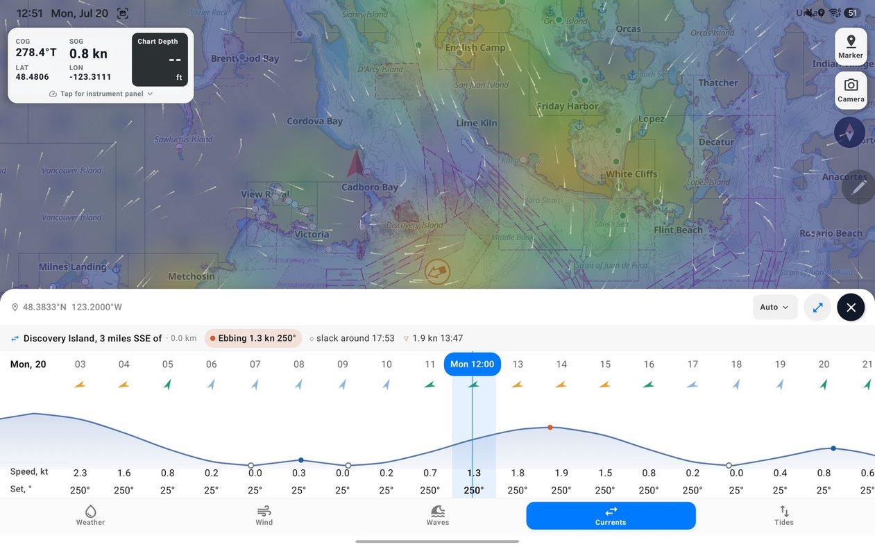
Hero image: SeaVectors showing current and tide stations across a coastal passage, with the Currents panel and animated overlay visible. Caption: "Government station predictions and modeled currents now share one chart — and the forecast can travel offline with you."
The forecast is easy to reach at the dock. The harder moment comes later: outside the harbour, around the first headland, when the signal becomes intermittent but the decisions keep coming. Is the wind still building? Will the sea lie down before the next leg? What will the current be doing when you reach the narrows?
This SeaVectors release is built for that part of the trip. It brings official Canadian Hydrographic Service and NOAA tide and current station predictions directly onto the chart, then lets you save 14 days of marine forecasts before departure. The local detail is there where it matters, and the larger weather picture remains available when the network is not.
Before your next trip, save a forecast for waters you know and see how it holds up away from shore. The 30-day free trial includes the complete experience, so you can test offline marine weather on a real passage before deciding whether to subscribe.
- Download SeaVectors on the App Store
- Get SeaVectors on Google Play
- Not ready to install? Open the lightweight web chart for a quick preview.
Local water deserves local information
A modeled ocean current is useful in open water. It is less convincing inside a narrow passage, where the shoreline compresses the flow and a few kilometres can separate calm water from a hard-running current.
SeaVectors now places CHS and NOAA tide and current stations directly on the chart. Current markers show direction, phase, and speed. Tide markers show whether the water is rising or falling and where the level sits in the tidal cycle. Put the crosshair over a station and its name and present prediction appear immediately; open the weather panel for the full timeline.
For currents, that includes speed and set, flood or ebb, the expected slack-water period, and the approximate turning point. For tides, it includes height, trend, and the next high or low water. These are official government predictions rather than a generic value borrowed from the middle of a forecast grid — the kind of local context that matters when timing a harbour entrance, channel, narrows, or tidal pass.
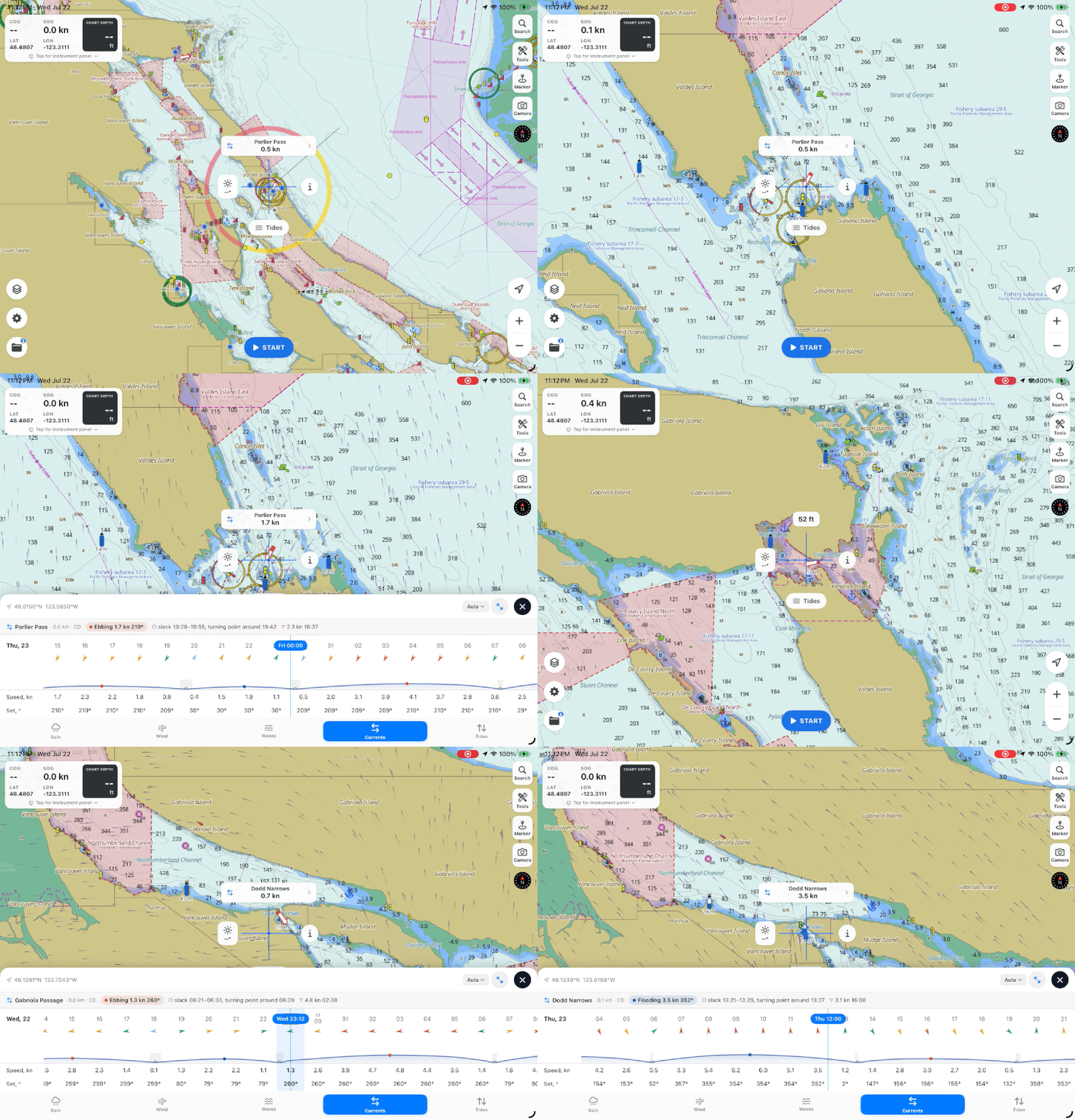
Image: a detailed current station marker at a tidal passage, with its station summary and slack-water window visible. Caption: "At a station, SeaVectors shows the official prediction; away from it, the chart returns smoothly to the modeled ocean current."
The animated current overlay keeps the two sources in their proper roles. Open-Meteo provides the continuous background across the chart, while nearby official station predictions make tightly localized adjustments around the waters they represent. A passage station informs the passage without pretending to describe an entire harbour ten kilometres away.
Fourteen days, saved before you cast off
The other half of the release is about continuity. In Settings → Offline Weather, Tides and Currents, one download saves 14 days of rain, wind, waves, tides, and currents for the visible map area. Frame the waters you expect to travel, download before departure, and the forecast remains available when cellular or satellite connectivity becomes limited or disappears.
Forecasts you view on the map are also cached automatically. The manual download is there for the deliberate version of that behaviour: preparing a cruising area, an offshore leg, or a week aboard while you still have a dependable connection.
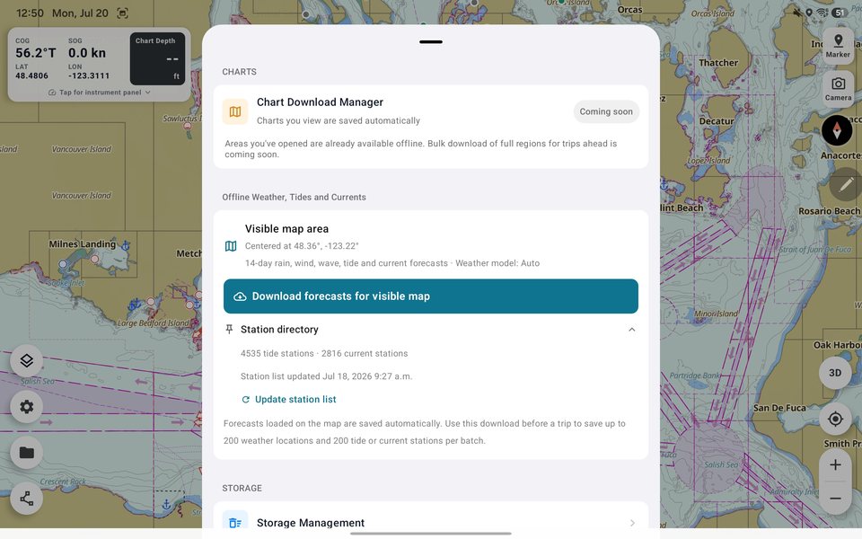
Image: the Offline Weather, Tides and Currents section showing a visible-area download in progress. Caption: "Save the visible cruising area before departure — rain, wind, waves, tides, and currents move offline together."
An offline forecast is still a forecast captured at the time you downloaded it. Refresh it as close to departure as practical, and continue to check official warnings whenever communications allow. The value is not that the forecast becomes certain; it is that losing the network no longer means losing the planning picture you left with.
One timeline for the whole passage
Weather rarely asks you to make one decision at a time. The wind may ease just as the opposing current strengthens. The rain may pass, but the sea state can remain uncomfortable for hours afterward.
The new full-screen forecast view places rain, wind, waves, currents, and tides on the same time axis. Scroll once and every row moves together. You can compare the conditions for the same hour instead of mentally lining up separate screens — useful for finding not simply the best wind or the best tide, but the best window for the whole passage.
Available now
The new station layer, current visualization, shared forecast timeline, and 14-day offline downloads are part of the latest SeaVectors release. The update also improves station synchronization, caching, download recovery, marker clarity, and map responsiveness while forecast data is loading.
Update SeaVectors from the App Store or Google Play before your next trip. New to SeaVectors? Start a 30-day free trial.